The Municipality of Bionaz is the northernmost of the Valle d’Aosta region and occupies the territory of the homonymous valley (Val di Bionaz), a tributary of the Valpelline. It is the third largest municipality in the Aosta Valley after Cogne and Courmayeur by territorial extension.
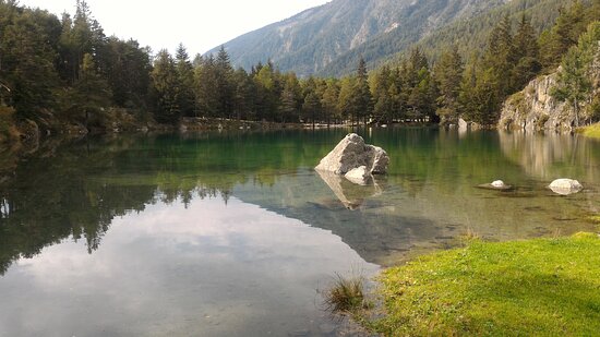
LAGO LEXERTThis small lake, located at an altitude of 1555 m, is easily accessible by car or on foot from the Ru village.The lake is adjacent to the parking lot.On the shore there is an area equipped for picnics and a drinks and ice cream kiosk open in summer.
DIGA DI PLACE MOULIN
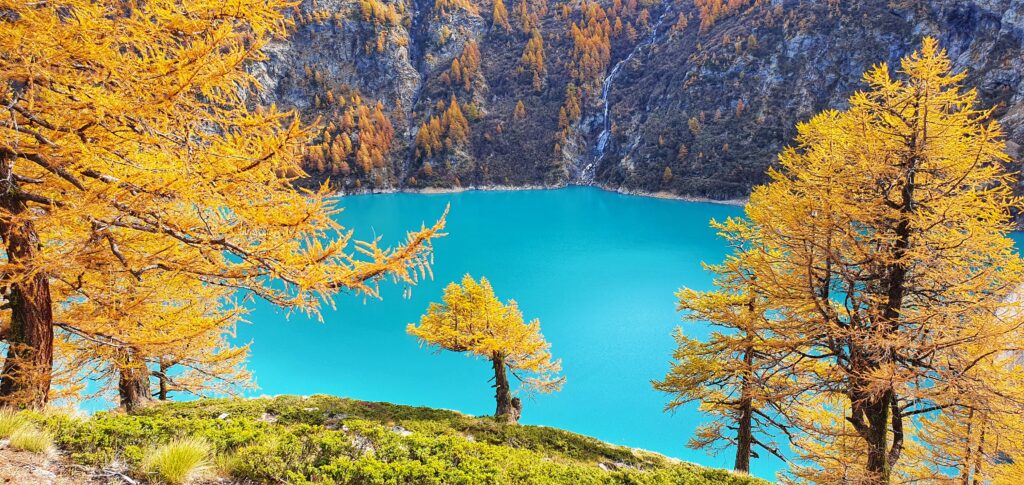
On the municipal territory there is one of the most important artificial lakes in the whole of the Aosta Valley, the lake of Place Moulin. Thanks to about twenty glaciers that extend over about 15% of the territory, Bionaz holds the primacy of “glacial”.Over the time the glaciers and the water coming from them have shaped the landscape in various ways, creating minor lateral valleys and forming alpine lakes.
Lago di Place Moulin
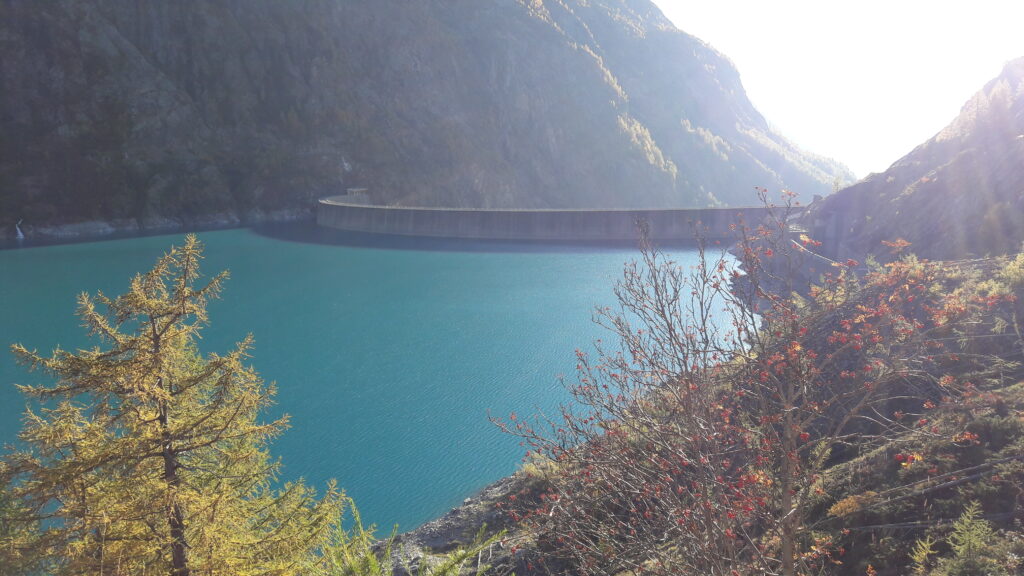
The Place Moulin dam is 155 meters high and 678 meters long. It is one of the largest dams in Europe.The lake is of an intense turquoise color. A path of about 6 km along the bank on the orographic right of the dam allows a nice walk, by mountain bike or even with a stroller, up to the Prarayer refuge.MOUNTAIN BIKECountless mountain bike itineraries in the valley, including the dirt road along the Place Moulin dam.But here’s another nice ride:
By (Conca di) and Alpe Thoules from Valpelline, tour with Glacier descent
difficulty: MC / OC / S3 [difficulty scale]
prevailing exposure: Various
departure altitude (m): 981
summit altitude / maximum altitude (m): 2378
total ascent height difference (m): 1600
Length (km): 30
mobile network coverage
vodafone: 80% coverage
no operated: 0% coverage
contributors: Rocciaclimb
last revision: 09/15/14
starting point: Valpelline (Valpelline, AO)
access:
Head to Valpelline and turn left towards Ollomont. Once in Frissoniere Inferiore, follow the road to the Visitor Center.
Technical notes:
Ascent never too hard with a long initial asphalted stretch, the dirt road always has good ground and slopes that are never excessive.
Descent on mule track (3-4-5) x Glacier on the orographic right decidedly technical (S3) with very continuous difficulties on rocky terrain with steps and well-set outcrops.
itinerary description:From Valpelline go up along the asphalted road to Ollomont for a few kilometers up to the junction for Frissonieres Inferiore, where you reach the Visitor Center; go up the dirt road to your left which immediately starts very steep.Once you reach a narrow asphalt belt, take the ramp to your right and then right again, in so doing you will reach the hairpin bend above Chatelair thus avoiding the asphalt from Doues. long road that without major slopes leads to Champillon where the dirt road finally begins.You now begin to descend slightly and always following the main road with some ups and downs you arrive first at By and then at Balme de Bal, destination of the tour. beyond up to Alpe Thoules 2378 m.
Descent:
Go back briefly along the uphill path and take the path that branches off on the left with a never too difficult path that leads to By. Glacier. Return to Valpelline along the asphalt.
FISHING
In the waters of the dam trout weighing up to 4 – 5 kg are caught. one, they see those 1 meter long, weighing about 9 – 10 kg, but they do not bite because they are full of small fish.
However, those that can be caught take the color of the lake, are white and blue like the waters, and are very good.
All the fish in the Aosta Valley is very good, because it is raised by the fishing consortium in the Municipality of Morgex.
Some recommended trips:
– Colle del Piccolo San Bernardo – Paid fishing – abundant fish (Fario, Char, Eridee)
– Comba di By: Lago Cornet – not full of fish – Lake Enclousa – medium fish abundance – Lake Leitù full of fish, but the brown trout do not grow (according to the fishermen)
– Lake Livournea – very fishy – only char – an area rich in ibex and chamois. Palasina lakes – go up from Verres towards Brusson and then Estoul – Parking on the square and then walk 2 and a half hours on a beautiful farm – 9 well-signposted lakes all full of fish and excellent landscape.
If you see that trout eat gnats (they fly) it is because nature is better than fishermen’s worms, and then you dream of them (Guido Denchasaz).
Special Reserve of Valpelline – Torrente Buthier – Municipality of Valpelline
Starting from the Ru Pompillard intake, in loc. Prailles, at the canal outlet in loc. Champette, in the Municipality of Valpelline, the reserve extends for about 3 km.
The stream, which originates from the glaciers of the Grandes Murailles, is easy to access and offers the possibility of fishing for trout larger than 500 gr.
Permit issuing points nearby:
Tobacconist Letey Sergio – Fraz. Capoluogo, 11 – Valpelline 0165/713507 (closed on Sunday afternoon)
Café du Moulin – Fraz. Capoluogo, 10 – Valpelline 0165/73251 (closed on Tuesdays)
Cost of the permit 35 € whether you do the NK or if you stay 6 heads, then you stop.
In Aosta take the road towards the Gran San Bernardo, deviate following the signs for Valpelline, pass the village and continue on the main road towards Bionaz, after 4/5 km you will find the stream that flows right next to the road. first bridge, leave the car and go down 100-150 meters. , access the stream and fish to go up for about 300-400 meters until the next bridge (or if you prefer until the end of the plain).
The trout can be seen and are beautiful 40 centimeters and more – they even reach 3/4 kg.
Return either from the woods or cross the bridge and get off the state road.
For any information: Valle d’Aosta Fishing Consortium Corso Lancieri 15 / D 11100 Aosta
Email: info@consorziopesca.vda.it
Tel: (0165) 40752 Fax: (0165) 1845152
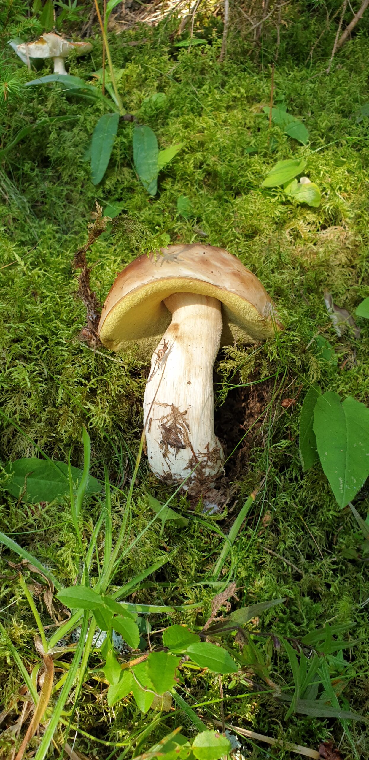
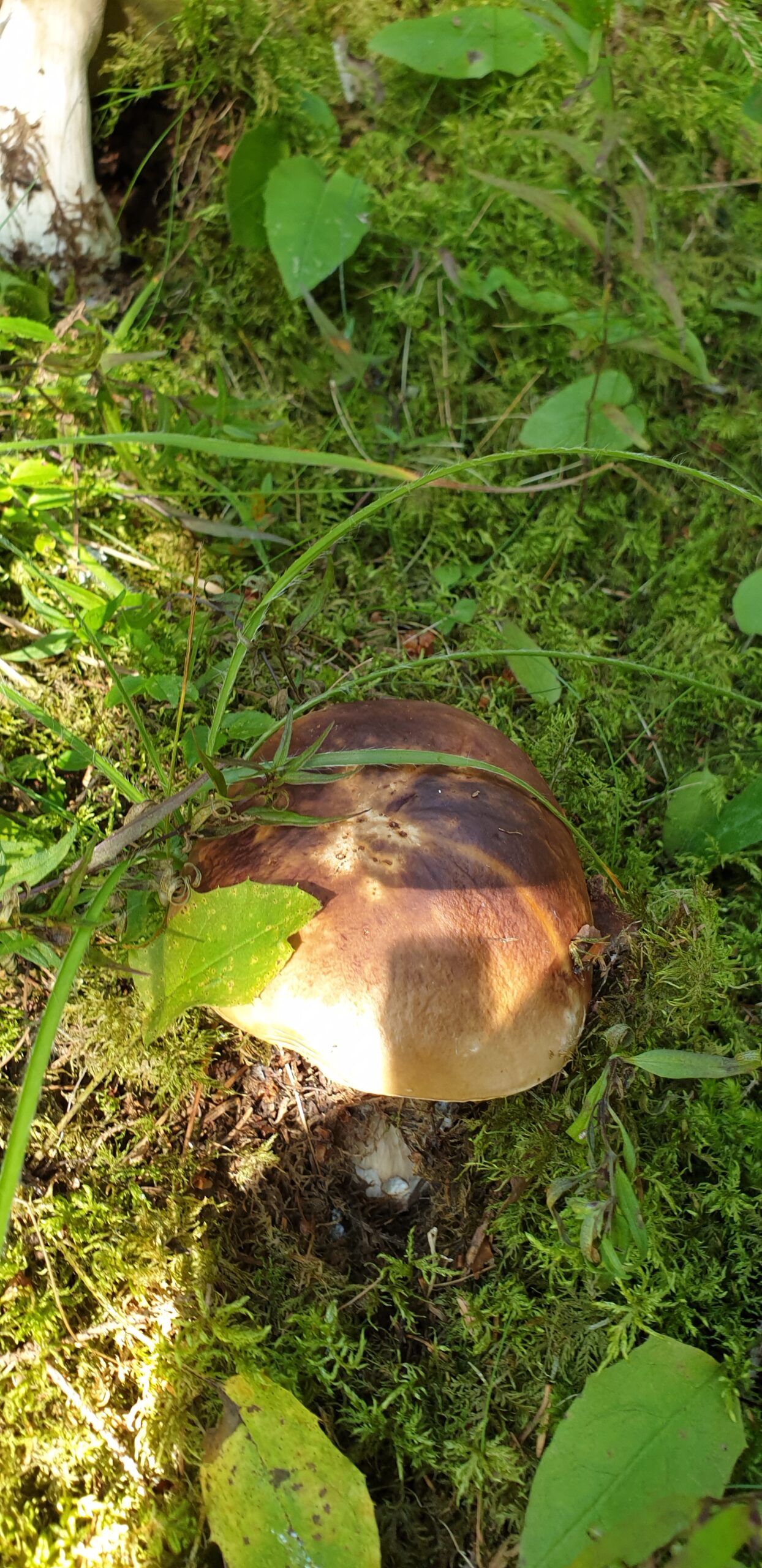
MUSHROOMS
It is possible to collect 1 kg of mushrooms per person per day in the woods above 1800 m. where the prohibition by the owners of the land is not exposed.
SNAILS24 specimens can be collected per person, per day.